Legacy Sediment

February 21, 2017

Have you ever wondered what happens to sediment once dams are removed? Scientists from Boston College and Franklin and Marshall are studying the effects. They’ve discovered that sediment once ponded by a dam in Lancaster County, PA traveled all the way to the Chesapeake Bay! This sediment transport effects nutrient availability and river morphology.

Links for more information and video of dam release:

Preliminary Survey of Legacy Sediments at Mill Dams in the French Creek

Upper plane bed configuration at the Feather River

February 19, 2017

The area around the Oroville Dam is still flooded and more rain is predicted per the latest weather forecast. The reservoir is lower than in previous days. However, the dam still remains a threat. The interactive model in the link below shows what the height difference looks like between the dam and the town below. The velocity of the water released would most likely create an upper plane bed and perhaps standing waves and antidunes along the bed of the Feather River. What is happening at this dam is similar to events that occurred at the Glen Canyon Dam.

Link for interactive 3D model: http://www.sacbee.com/news/local/article133545764.html

Snowflake Analysis

Shoveling has been a reoccurring theme for the previous week with two winter storm systems coming through. Snow/ice is classified as a mineral meaning that we have the ability to classify it! Take out your hand lens and grain size chart and determine what size particles you are shoveling, skiing, or sledding in! Bonus-the snowflakes look pretty underneath a hand lens too! Laminations can also be observed in the cross sections of snow along driveways and walkways.

More about snow: https://nsidc.org/cryosphere/snow

Plinthite

February 17, 2017

I learned about this mixture in my soils class last week, called plinthite. I am not sure whether or not it is considered a rock, or soil. It is a mixture of clay, quartz and other minerals that hardens when it gets wet, supposedly irreversibly hard. I find this rather interesting, because I would think that if it hardens irreversibly it would be a rock, but it it doesn’t have cement holding it together, and is not compacted, as a sedimentary rock would be. that leaves this as a type of soil, but one that is incredibly hard. Any thoughts?

http://www.isric.org/isric/webdocs/docs/major_soils_of_the_world/set6/pt/plinthos.pdf

Skiing and Sediment Transport

Downhill skiing can be an analogy for sediment transport in fluvial systems. Skiers that stay on their feet can be thought of as suspended particles. Skiers that end up summersaulting can be thought of as incipiently suspended load. Skiers that fall flat on their face can be thought of as bedload where the critical shear stress is greater than the basal shear stress, so they won’t move.


Pollution in the Mariana Trench

February 16, 2017

Wanna hear some bad news? Scientists have recently discovered that the Mariana Trench, a huge void caused at the intersection between two tectonic plates, is absolutely loaded with harmful pollutants that are damaging all sorts of ecosystems. We used to be confident that the Mariana Trench, a setting even more hostile than the top of Mount Everest, might have escaped from the influence of human pollution…but chemicals such as PCBs and PBEDs are sinking down to this void and developing into the fatty tissues of deep ocean creatures that call that place their home. These chemicals, which have been banned in parts of the world for over thirty years, persist in the environment for a very long time. Animals in the oceans absorb and then retain these chemicals in their fat tissues, which then get utilized by larger life forms like whales. These pollutants have a tendency to make their way up food chains, effecting humans in the long run. Here’s an interesting article about the trench:

http://www.smithsonianmag.com/smart-news/even-deep-sea-creatures-are-poisoned-human-pollutants-180962170/

Volcanic Bomb intrusions and Faults on the eastern coast of Taiwan

February 15, 2017

On the eastern coast of Taiwan, we examined these large intrusions in the rock, which we interpreted to be bombs expelled by massive volcanic eruptions, estimated to have occurred between 7 and 12 ma. Additionally at this site, we observed very obvious and powerful faults. With a water bottle and my friend Santos as a size comparison, we can see that these bombs approach 1 meter in diameter.

16807676_10208504218026398_1954808693317209754_n16796962_10208504217346381_8016455424491875494_o


16807121_10208504216946371_9174294191578339311_n 16807371_10208504217746391_220816943199648040_n

QFR ratios of sediments

I found the pictures I took of our sediments when we were analyzing QFR ratios to be really cool. Using my microlens, I was able to use my smartphone camera to focus on the sample. It’s cool how the optics only allowed the image to focus on the center of the sample, giving the image a really cool effect. The detail on the quartz grains was very interesting, as many of the samples were almost pure. That being said, It was very difficult to find a sample of feldspar without any impurities.


16797273_10208504113263779_8496765231389506023_o


16807191_10208504113183777_3763274342485659972_n 16807625_10208504113223778_6539770953984842829_n

Sediment transport in the Taroko Gorge, Taiwan

16729131_10208504220346456_9044952430748665904_n

Remembering my trip to Taiwan last month, I figured a lot of the sites we observed could be relevant to sedimentology. When we traveled to the Taroko Gorge, an enormous deep canyon flowing out to the eastern coast of Taiwan, there were some amazing sediments along the river. This image depicts some of the massive sediments which have been transported by extreme flooding. The extreme typhoons which hit Taiwan can result in over a meter of rainfall per day, generating incredible floods capable of moving truck sized boulders. Additionally, along the banks of the river, there are a wide range of rock types. The very rounded clasts along the banks show at least 10 different compositions and a range of colors, indicating many sources of sediment. Indeed, the extremely steep slopes and cliffs in the mountains of Taiwan, coupled with heavy rainfall and earthquakes allow for extremely rapid generation of sediments. Additionally in this image, a large sediment deposit can be observed on the inside of the curve of the river.

16729054_10208504217946396_352239141261032419_n 16649446_10208504219346431_7448742783767893530_n 16649176_10208504219306430_634570971375718974_n 16711883_10208504217066374_5187030756961868614_n


16711996_10208504041021973_8378597636124634964_n

Sediments Entering Feather River

February 14, 2017

The Feather River is is the outlet for the Oroville Dam. Floodplain deposits besides this river would tell us the shear velocity during certain floods and what particle sizes would comprise the suspended, incipiently suspended, and bedload. If the sediments behind the dam were cored, we could figure out what shear velocity is necessary for the largest particle size to be carried in the suspended, incipiently suspended, or bedload. This would enable us to figure out what velocity of the river would deposit the largest and coarsest amount of sediment on the floodplain.

Link for info on possible flooding of the Feather River: http://www.latimes.com/projects/la-me-oroville-flooding/

The Need for Environmental Protection Policies

http://www.courant.com/breaking-news/hc-tolland-crash-evacuations-0213-20170212-story.html

As many of you have probably already heard, a tractor trailer slid off of I-84 in Tolland Sunday night.  This vehicle was carrying roughly 900 barrels of chemicals that were being transported to a facility in Massachusetts.  When it slid off the road, on a section state police Sgt. Kenneth Albert described as a treacherous stretch of I-84, the presence of snow and slush compounded this issue.  This is why the state had snow plows out clearing the roads and placing salt down prior to, through, and after the storm to keep the roads as safe as possible.  Even with those precautions in place, the truck still slid off the road and cleanup crews had a difficult time reaching it, creating a potentially serious hazmat scare.  Luckily, none of the barrels wound up leaking, allowing the cleanup to occur much faster.  If they had leaked into the snow and soil however, the risk would’ve increased exponentially.  Melting snow can carry the contaminant into surface bodies of water.  The chemicals could also move through the soil, contaminating any local aquifers.  The quick cleanup helped avert disaster, but having these kinds of policies in place to prevent and respond to such disasters is a necessity.

Erosion on the Oroville Dam Spillway

February 13, 2017

http://www.cnn.com/2017/02/12/us/california-oroville-dam-failure/index.html

The area around the Oroville Dam in California is currently being evacuated as the primary spillway of the dam has been damaged from erosion. This article shows the huge holes in the concrete spillway that were caused by overflow of the dam from recent large amounts of rainfall. California was facing a huge draught up until recently, so the spillway had not been used in a long time. The damage from this erosion could lead to the failure of the dam and massive flooding of the area. This is an example of erosion on a very large scale. California is now hoping for no rain, which is a very different story from a couple years ago.

Sand for Snow and Ice

February 10, 2017

Portland begins cleaning sand and gravel off roadways after recent snow storm

This link brings you to an article about the Portland Bureau of Transportation, and how they use sand and gravel to provide traction for cars on the road, and the cleanup afterward. While cleaning up the sand and gravel may seem tedious, I believe that it is a much better alternative than an excessive use of salt to remove ice and snow. Salt is NOT a replacement for snow shoveling and plowing. Sand is a much more environmentally conscious way to prevent ice from being a problem. It can be removed after the ice and snow have gone, and if some of it remains in the environment, it moves along with the rest of the sediment that is in the system. However, salt will dissolve into snow and ice, and move with it into the groundwater, lakes, and streams. There it will remain. As water evaporates, salt stays behind. As water goes through the ground the salt can get trapped, and increase the salinity of the soil. Since both groundwater, and surface waterbodies are used for drinking water, this salt stays in our water- since no treatment short of evaporating the water (which uses a lot of energy for a small yield) and reverse osmosis (which is expensive, and you end up with brine that must be disposed of) will remove the salt, people drink salty water. This can be an issue for people who are older, or younger, those with heart conditions, and a variety of other ailments-let alone the impact that salty water will have on the plants and animals in the system.

Formation of the Sahara

February 8, 2017

How did the mighty Sahara Desert form? This huge desert, the largest in the world not counting the Arctic or Antartica, covers roughly 10% of Africa. How does such a structure form? According to this article: (http://www.sci-news.com/othersciences/paleoclimatology/science-sahara-desert-formed-7-million-years-ago-02160.html) the region in the north of Africa first started experiencing desertification over 7 million years ago during the Tortonian stage (7-11 million years ago). Before this time, Africa was bordered by the Tethys sea. This sea brought this region of Africa plenty of moisture, and allowed lush vegetation and deep soils to grow. Due to the cycles in climate and the movement of tectonic plates, the Tethys sea eventually dried out, and the region of the great desert became susceptible to arid conditions.

The nail in the coffin was the changing tilt of the Earth’s axis. The tilt used to be more severe around 5000 years ago. When the tilt decreased in severity the upper region of Africa stopped getting large monsoons, an important part of the ecosystem and vegetation that depended on the annual water surplus. Without these monsoons, plants couldn’t survive, soils couldn’t grow, and the Sahara began to form.

Another Use for that Christmas Tree you Take Down Every January

http://www.loyolamaroon.com/10012165/worldview/state/christmas-trees-stop-coastal-erosion-in-jefferson-parish/

I came across this article recently and, while a little late for this winter, it may get people thinking about what to do when the holidays are over in future years.  Louisiana is very susceptible to coastal erosion, which can affect both domestic and commercial structures and activities.  To combat this, a state project is attempting to rebuild and reinforce the coastline through discarded Christmas trees.  By placing them in wooden “cribs” in the bayou near the coast, the project attempts to rebuild a coastline that gets decimated by coastal erosion.  So, when the time comes every January to put away the Christmas decorations and get rid of the tree, consider that the tree may be useful in another way by protecting coastlines.

Major Types of Dunes: Where and How They Form

February 7, 2017

By: Madeline Kollegger and Taylore Grunert

Parabolic

Parabolic dunes – also called U-shaped, blowout, or hairpin dunes – tend to form where vegetation covers the sand. Winds may erode a section, pushing the sediment leeward. The vegetation will hold back the arms of the dune, so that the dune points in the leeward direction. The animation below gives a basic overview of how they form. They are most common in coastal deserts. Sometimes, parabolic dunes can come from transverse or barchan dunes, given that the dunes stay static enough for vegetation to grow on them.

Parabolic dune animation

(National Park Service)


Star

Star dunes are a rare, interesting dune structure, that pepper landscapes in sandy deserts. They form when alternating and multiple wind directions pile sand in a location, and forms a peak, with many arms extending from the center (Fun Facts…). Star dunes make up 8.5% of all the dunes on the planet, and they often form in large groups in a dune field (Star Dunes). Many of these fascinating dunes can be seen in the Sahara desert, especially in the Grand Erg Oriental, a “sand sea” of dunes.

Barchan

Barchan dunes are crescent or half-moon shaped, and are thus also called crescentic dunes. They form where conditions are ideal. They require a flat landscape, winds from only one direction, and limited sand. However, these exact conditions are rare, and so is this type of dune, although they are found in all types of deserts. Barchan dunes point against the wind. Their faces are steep, but their trailing sides are not. They will often join up with other barchans to form barchanoid ridges.

aslfjlksdj

(World Landforms)

Longitudinal

Also called linear dunes, longitudinal dunes look like large, parallel needle-esque features on the landscape. They are straight, and long, unlike the typical dune that people imagine. This dune type forms when sand is not in excess, and when wind blows in one constant direction. Over an extended period of time the dunes will migrate in the direction the wind is blowing.

The below dunes are in Egypt.

sldfjs

(NASA EarthKam)


Works Cited

“Barchan Landforms”. World Landforms, n.d. Web. Retrieved Feb. 6, 2017 from http://worldlandforms.com/landforms/barchan/

Blumberg, Dan G. and Haim Tsoar. “Formation of Parabolic Dunes from Barchan and Transverse Dunes Along Israel’s Mediterranean Coast.” Earth Surface Processes and Landforms, vol. 27, no. 11, pp. 1147-1161, 2002.

“Dune Types.” National Park Service, n.d. Web. Retrieved Feb. 6, 2017, from https://www.nps.gov/grsa/learn/nature/dune-types.htm.

“Star Dunes.” DKfindout!, n.d. Web. Retrieved February 06, 2017, from http://www.dkfindout.com/us/earth/deserts/star-dunes/

Star Dunes in Algeria. (n.d.). Retrieved February 06, 2017, from http://earthobservatory.nasa.gov/IOTD/view.php?id=81996

“Types of Dunes.” Exploring Earth, n.d. Web. Retrieved from https://www.classzone.com/books/earth_science/terc/content/investigations/es1603/es1603page04.cfm

“Types of Dunes.” USGS, n.d. Web. Retrieved Feb. 6, 2017, from https://pubs.usgs.gov/gip/deserts/dunes/

Formation of White Sands National Monument

February 5, 2017

The National Parks website explains how the White Sands National Monument was created over the last 280 million years.  From a sea, to a mountain range, to a rift basin, to a lake, to a playa, to a desert, to the dunes.  More sediment is added to the dunes by wind and water breaking down and transporting selenite crystals.

https://www.nps.gov/whsa/learn/geology-of-white-sands.htm

Parabolic Dunes

February 4, 2017

https://phys.org/news/2017-01-invasive-sedge-dunes-native-grass.html

I saw this article about invasive species being better at protecting a dune from erosion than native species, and it got me to thinking. When we were outside Wilbur Cross we talked about two different types of dunes, barchan dunes, and parabolic dunes. Barchan dunes move with the limbs first, while parabolic dunes move crest first because vegetation anchors down the limbs. I wonder if the parabolic dunes have invasive species anchoring their limbs so well that it could prevent movement of the limbs completely, and change the shape of the dune?

Sediment in Rivers

February 1, 2017

Below are two different articles about different rivers located in very different parts of the country, both bodies of water have issues with sediment in the flow of the river. The south river located in Maryland will have less sediment in the water, as the current load of sediment has clouded up the water, and created algae blooms. In Wyoming there is plans to perform studies to determine if more sediment should be released.


http://www.wyomingnews.com/news/bill-would-allow-sediment-to-flood-rivers-each-year/article_cb914ed8-e84b-11e6-99ce-4b500c0fa7e4.html

http://www.baltimoresun.com/ph-ac-cn-south-river-tmdl-0202-20170201-story.html


Lava Fire Hose

http://sfist.com/2017/02/01/video_lava_stream_dramatically_pour.php

Check out the video from this link. In Hawaii, the Kiluea volcano has been producing an igneous delta with non-viscous magma. Recently there was a landslide of sorts, which exposed a huge opening adjacent to an active lava tube. The result is this incredible outpouring of liquid rock…some of the most incredible nature footage i’ve ever seen on the internet. The lava outpour sends huge chunks of rapidly cooling rock all over place…showing the sheer amount of energy and material that can come out of volcanoes.

Tourists are being warned away from the site, as volcanologists say this outpouring from an active lava tube can be interpreted as a sign of growing instability around the volcanic site. Pretty crazy!

Danxia Landform in China

"A visitor stands at a viewing platform in the Zhangye Danxia Landform Geological Park in Zhangye, northwest Chinas Gansu province, 22 September 2012."
This picture shows the Danxia Landform in China.  This was created by layers of red sandstone and other colorful minerals.  The beds of sandstone were then deformed from tectonic motion.  This just shows how different minerals present in sediment can greatly change the appearance and end result of the sedimentary rock.

The Destructive Beauty of Volcanism: 2016

https://www.theatlantic.com/photo/2016/12/2016-the-year-in-volcanic-activity/510641/

http://volcano.oregonstate.edu/volcanic-lightning

While this article from The Atlantic was more of a slideshow, the captions for many of the photos did a good job simplifying complex processes.  The image that really captured my attention was the first image in the slideshow.  This was a picture of volcanic lightning forming above the erupting Sinabung volcano in Indonesia.  The second article I linked above provides a simplified process for how volcanic lightning forms.  These images can be absolutely breathtaking, something one may only expect to see out of a videogame.

Not only are these volcanoes beautiful, but they can be both destructive and provide resources to local communities.  Eruptions can bring useful minerals to the surface, which can then be used in manufacturing, yet they can destroy communities in the process, as seen in the case of San Juan Parangaricutiru, Mexico, and most notably, Pompeii, Italy.

Stone Candle Holder

January 28, 2017

Stone Candle Holder

My parents just got back from a trip to Arizona, and the Grand Canyon. They brought me back this stone candle holder. I find the different layers incredibly interesting, but I’m wondering what all the dark lines between the different sections/top could be-they are slight ridges that stick out of the side of the holder. Also, I wonder how cylinder was formed- would a rock corer form a sample that could be shaped into this holder? Or could a corer disintegrate the rock into little pieces?

Help for the Mississippi River from Obama

January 26, 2017

http://www.nola.com/environment/index.ssf/2017/01/mid-baratara_sediment_diversio.html

One of the last few things President Barack Obama did was approve this sediment diversion on the west bank of the Mississippi River. This sediment diversion is a beginning part of the 50 year, $50 billion project to stabilize the wetlands and coastline of Louisiana. The diversion will move 75,000 cubic feet per second of sediment and water from the Mississippi into Barataria Bay, which used to be marshlands. The movement of sediment is now quite politicized so we’ll have to see what happens next to the Mississippi River Delta during the new administration.

Sediment Loss on the Mississippi River Delta

mississippi

The Mississippi River Delta is losing a football field of wetlands every hour. This is partly because of all the levees being built along the Mississippi River to stop the river from flooding communities. The levees may seem like a good idea to the people living alongside the Mississippi, but the river needs to naturally flood and change course to maintain the ecosystems that it supports. The wetlands on the coast of the Gulf of Mexico rely on the sediment that the Mississippi River deposits. If the levees stop the sediment from reaching the wetlands, then the wetlands will stop growing and eventually will be lost to the sea.

In our lab, we saw how the flow of water over our miniature delta changed coarse many times and began to form new channels. This is a natural process that needs to also occur on large scale deltas and rivers. New methods of flood control need to be implemented so that sediment can continue to be deposited at the delta. Communities have learned that levees can fail so some are now flood-proofing businesses and elevating homes. Also, through the use of sediment diversions, the river can be connected back to its delta so that the river can continue to build up the wetlands. There is also a lot of dredged sediment from making shipping canals that is typically dumped offshore. This sediment could instead be placed where sediment is needed in the wetlands. It is also important to research how best to solve this issue and what the consequences of these solutions are.

After discussing the importance of sediment deposition and how it creates important ecosystems, like wetlands, it is obvious that this issue needs the attention of geologists and engineers. The Mississippi River Delta provides 25% of our fishing and seafood industry, major commercial channels for shipping, millions of jobs, and the habitats for hundreds of wildlife species. As a Geoscience major, I know that I want to have a career where I put my knowledge to use and make positive impacts on our environment. This is definitely an issue that would be worthwhile to work on to help make a difference.

http://www.mississippiriverdelta.org/discover-the-delta/what-went-wrong/

A New Way to Protect Salt Marshes

This article discusses a new way people are determining if salt marshes are vulnerable to erosion. The system that they used creates estimates with large margins of error, meaning that this ratio can only truly be used to predict whether a marsh has enough incoming sediment to thrive or disappear. Perhaps this ratio can be used in the future to help preserve salt marshes.


https://www.sciencedaily.com/releases/2017/01/170124111312.htm

Channeled Scablands

January 25, 2017

20,000 years ago the Cordilleran Ice Sheet was moving north. In western Montana a particular ice lobe from this sheet blocked a crucial valley in a  place called Clark Hill. Because this crucial pass was blocked off, melt water from the ice sheet began to fill a giant basin now referred to as Missoula. The Missoula basin filled with an extreme amount of water over a relatively short amount of time, and eventually, the pressure became too much and the ice lobe blocking the basin in collapsed. What resulted is believed to be one of the largest floods in the history of the world….the outflowing of water was estimated to be greater than the combined flow of all rivers currently in the world. This massive wall of water roared across Montana and Washington, creating a series of lakes, before joining the ocean.

This flood ripped away many feet of loess, the soil that was found on the ground at the time. What results now-a-days is the channeled scablands, a barren basalt wasteland with a remarkable geological past and indued with landforms such as giant pot holes from the swirling water, and square coulees. Scientists didn’t believe that such an event could happen at the time, and Brentz, the man who proposed the idea of the Missoula Floods, was mocked and ridiculed. Over time though, the scientific community accepted that such catastrophic events have their own special place in the formation of the planet’s surface.


Source: http://www.sevenwondersofwashingtonstate.com/the-channeled-scablands.html

Sam Horvath

The Grand Canyon, From the Sediment Perspective

Madeline Kollegger and Taylore Grunert

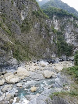
The Grand Canyon is known around the world for its incredible layers, and defying depth. It formed from the bed of the Ancient Colorado River, as it wound around the plateaus in the Colorado Plateau Province. The water in the river, and the sediment it carried wore away at the bed for ages, until the canyon was formed. The very bottom layer of the Grand Canyon is made from sediment and lava deposits that were later uplifted into mountains.  (United States)

xcolplat

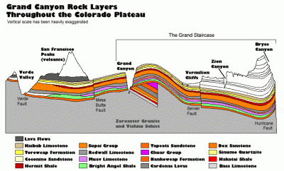
Figure 1: Grand Canyon Rock Layers Throughout the Colorado Plateau.


While made of many layers, from a variety of different times, and events, most of the rock that makes up the Grand Canyon is sedimentary. The sediments that form the rocks were deposited by the advance and retreat of ancient ocean shorelines due to changes in climate. As the earth was colder, there was more ice, and the coastlines were farther out, and as it was warmer the lack of ice caused the sea levels to rise.

The top layer of the Grand Canyon is the Kaibab Limestone, ages about 250 million years old. It contains the fossilized remains of a variety of ocean creatures such as mollusks and coral. Looking at other formations in the Colorado Plateau (see Figure 1), we know that  younger layers have been eroded from the Grand Canyon. Bryce Canyon, farther north from the Grand Canyon has layers that are dated as much younger.

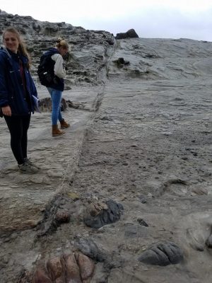
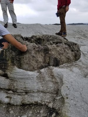
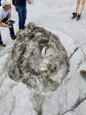
The oldest layer of the Grand Canyon is known as the Bass Formation, dated 1.25 billion years ago. This layer contains algae (Stromatolites) that reaffirm that the area was ocean at the time the sediment was deposited. However, the base of an ancient mountain range is the very bottom of the canyon, formed about 1.7 billion years ago. Between that ancient mountain range, and the Bass Formation, there is a rock unconformity that indicates changes and missing rock from the record. There is another unconformity between the layers known as the Chuar Group, and Tapeats Sandstone. Dated at 250 million years ago, the unconformity also indicated a change in the rock record, missing layers. (Geology)

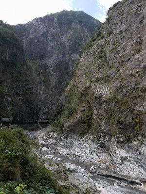
Today, the Grand Canyon is protected as part of the National Parks system. However, it still faces multiple threats from human activity. For example, the Grand Canyon ecosystem has been greatly altered by the controversial Glen Canyon Dam (Loomis). Certainly, the sediment and water accumulation caused by the dam has changed how this system functions in the Grand Canyon.

Additionally, this protection has historically been threatened by mining interests, and continues to be. Uranium mining not only contributes to the destruction of geological features in the canyon, but also pollutes rivers and creates toxic conditions for all living things, including people (Grand Canyon Trust).

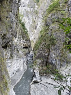
Furthermore, the Colorado River itself is extremely overused and mismanaged. This isn’t necessarily bad for the canyon itself, as decreased input into the system by water would mean decreased erosion. However, this is still, on the whole, negative: it adversely affects ecosystems, people, and the economy (Davis).


Works Cited

“Administrative History of Grand Canyon National Park”, 2000, National Park Service. Retrieved Jan. 24, 2017 from https://www.nps.gov/grca/learn/historyculture/adhigrca.htm

Davis, Shoshana. “Colorado River Named Nation’s Most Endangered Waterway”, CBS News, April 22, 2013. Retrieved Jan. 24, 2017 from http://www.cbsnews.com/news/colorado-river-named-nations-most-endangered-waterway/

The Geology of the Grand Canyon. (n.d.). Retrieved January 24, 2017, from http://www.bobspixels.com/kaibab.org/geology/gc_geol.htm

“Grand Canyon Uranium Mining” Grand Canyon Trust, n.d. Retrieved Jan. 24, 2017 from http://www.grandcanyontrust.org/uranium-mining

United States. National Park Service. (n.d.). Geologic Formations. Retrieved January 24, 2017, from https://www.nps.gov/grca/learn/nature/geologicformations.htm

Loomis, Brandon. “50 Years Later, Glen Canyon Dam Still Controversial”, USA Today, Oct. 14, 2013. Retrieved Jan. 24, 2017 from http://www.usatoday.com/story/news/nation/2013/10/14/glen-canyon-dam-50-years/2981273/


River Incision experiment

January 20, 2017


We attempted to generate the highest incision rates as possible in this sediment simulation. By increasing the flow rate and making the channel as narrow as possible, the water will flow extremely rapidly. However, the channel continues to widen as the canyon walls collapse. This is especially true along the edge of the outside of a curve of the channel, as the walls are exerting a normal force on the water causing it to accelerate towards the inside of the curve. This causes the most rapid rates of erosion along this channel. This is also where the water is traveling fastest, and the water becomes deepest. Along the inner banks of the channel, sediment is deposited, and the flow rate is much slower. These areas become much shallower and the river is not incising significantly in these regions.

Additionally, in order to generate the fastest possible flow rate, we increased the slope by piling large amounts of sand directly on the source of water. This allowed the source to be much higher, and the river to begin with much more gravitational potential energy which would be converted into the maximum possible kinetic energy as the stream flowed from above to below.

Picture1

Cross Bedding in the Flume


Capture

I was surprised to notice that, while we were playing with the flume, cross bedding had formed. The first layer of bedding was already there at the start of the lab. The next two layers formed once we changed the velocity of flow, causing the water levels to sink and rise. I thought it was fascinating to watch the erosion and deposition, but it was also really interesting to see how coarse and fine grains sorted themselves. For example, on the topmost layer, the darker bands are fine sediments, while the light layers are coarse sediments. It was interesting to think how this process would apply in nature, especially in eolian environments where dunes form.

Ganges River – Pollution

The Ganges River is one of the world’s largest, and feeds the largest delta in the world. This river starts in the Himalayas, getting fed by the melting glaciers there. Scientists estimate that the Ganges River and Delta, which have already seen their fair share of natural disasters, may become even more dangerous when climate change accelerates the rate of glacial melting. Another problem with the Ganges is pollution. A large business in India is cremating bodies so that the ashes get dumped into the Ganges river. It is believed that this helps the soul break out of the cycle of continual rebirth, and achieve liberation from the mortal world. Those that cant afford cremation, however, often just send their deceased down the river, which contributes to making the sacred river even more polluted and toxic. Billions depend on the life-giving quality of the Ganges and the Delta, as the water helps support the growth of many agriculture businesses. Here’s a neat article:

http://www.newsweek.com/2015/10/02/ganges-river-dying-under-weight-modern-india-375347.html

A Call for Levees on New York’s Waterfront

http://science.time.com/2012/11/02/manhattan-goes-dutch-building-levees-in-gotham/

In his discussion of the plan to build levees to protect New York City, Jeffery Kluger discussed the possible structural and economic impact posed by another storm such as Hurricane Sandy.  In his article, he focused on Manhattan, discussing how the geology of the island is primarily granite.  Due to this, if storm surge can be managed, he states that much of the damage can be mitigated, as citizens would not need to worry about the water weathering the island.  This is mostly true, as the quartz and any garnets in the granite are resistant to weathering, but the mica and feldspar would be much more susceptible to the warmer, and greater quantities of, sea water.  Depending on the composition of the granite, this could prove to be a virtual non-factor in adjusting for possible weathering or could prove to be another obstacle that must be managed.  Regardless of the composition, Kluger was correct in his assertion that levees would be necessary, but also in saying that pumps would be necessary to prevent water from pooling up, as this would increase the possibility for the mica and feldspar in the granite to dissolve.  This would be limited by  the lack of movement of the water, but it could still cause significant problems.  This weathering could also prove problematic if a major storm were to occur during the late fall, as did Hurricane Sandy, or early winter, allowing water to enter the cracks and potentially freeze, leading to more damage over a long period of time.

$50 Billion Not Enough to Restore Louisiana Coastlines

On January 18, the Coastal Protection and Restoration Authority had a meeting to discuss repairing the 1,800 square miles of land lost between 1932 and 2010. Unfortunately, complete restoration is impossible. “As much as we would like to have the coast that we had in 1932, there’s no question we can’t get there,” Haase said. “We’re never going to be able to restore it to that level.” The draft includes scenarios for flood damage and land loss based on high, medium and low estimates using different levels for environmental drivers. However, even under the 2017 medium scenario, Louisiana could lose 2,254 square miles of land over the next 50 years without action.

The plans recommend building 802 square miles of land under the medium scenario. But this plan needs $50 billion. Bren Haase, chief of planning and research, said $150 billion is preferred “but is likely unrealistic in the state’s precarious fiscal situation”. Under the plan, half the money would go towards restoration, the rest towards risk reduction.  Though numbers show that investing now would lower future losses by $8.3 billion over the next 50 years under the medium scenario. As we’ve talked about in class, Louisiana’s ports are vital to the economy. But future planning using today’s dollars is never a strong trait of government, so we’ll see.


-Maddi Nicholson
http://www.nola.com/environment/index.ssf/2017/01/louisiana_will_never_be_able_t.html#incart_river_index

Sediment: Not Good To Spill

http://www.sltrib.com/home/4267539-155/dam-project-fills-american-fork-with

http://www.heraldextra.com/news/local/north/american-fork/monitoring-clean-up-plan-for-tibble-fork-sediment-spill-still/article_20f70fe9-f9b9-59ea-90ca-89cc55c750ac.html
These are links to articles that talk about a sediment spill in August 2016 that killed fish in the American Fork River. The sediment (which was accidentally spilled) was laden with heavy metals, and was part of a dam rehabilitation project upstream. As the fine grain sediment settled, in some places it made layers up to two feet thick on the bed. This situation is something that I hadn’t thought about before. Usually I associate sediment as innocuous to the environment, although it does have the negative effects when it is in excess of burying wetlands.  However, after reading the article I realize that fine grain materials suspended in the water in excess choked the fish