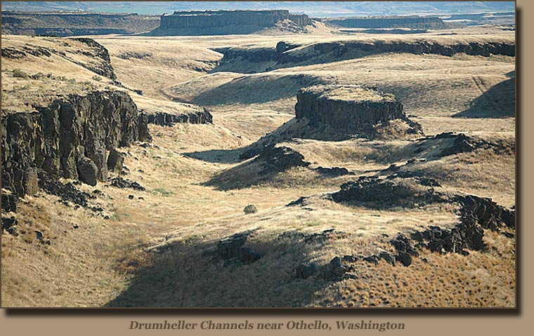
20,000 years ago the Cordilleran Ice Sheet was moving north. In western Montana a particular ice lobe from this sheet blocked a crucial valley in a place called Clark Hill. Because this crucial pass was blocked off, melt water from the ice sheet began to fill a giant basin now referred to as Missoula. The Missoula basin filled with an extreme amount of water over a relatively short amount of time, and eventually, the pressure became too much and the ice lobe blocking the basin in collapsed. What resulted is believed to be one of the largest floods in the history of the world….the outflowing of water was estimated to be greater than the combined flow of all rivers currently in the world. This massive wall of water roared across Montana and Washington, creating a series of lakes, before joining the ocean.
This flood ripped away many feet of loess, the soil that was found on the ground at the time. What results now-a-days is the channeled scablands, a barren basalt wasteland with a remarkable geological past and indued with landforms such as giant pot holes from the swirling water, and square coulees. Scientists didn’t believe that such an event could happen at the time, and Brentz, the man who proposed the idea of the Missoula Floods, was mocked and ridiculed. Over time though, the scientific community accepted that such catastrophic events have their own special place in the formation of the planet’s surface.

Source: http://www.sevenwondersofwashingtonstate.com/the-channeled-scablands.html
Sam Horvath